IOS:高德地图-高德打车,导航公交地铁出行 App – App Store
Android:高德地图
Amap, also known as Gaode Map, is a top-rated navigation and mapping app optimized for travel and daily life in China. It provides accurate real-time driving, walking, cycling, and public transit directions with live traffic updates and precise arrival estimates. The app supports an English interface, offline maps, and clear voice navigation, making it ideal for foreigners. Users can search for attractions, restaurants, hotels, subway stations, ATMs, and restrooms, with detailed information and reviews. It integrates ride-hailing and taxi services, helping users compare options and book rides quickly. Amap offers precise metro and bus routes, including exit information and transfer guidance to avoid confusion. Unlike many global maps, it works smoothly in China without a VPN and covers cities and rural areas with high accuracy. Easy to use and highly reliable, Amap is a must-have app for foreigners traveling, studying, or living in China.
Amap User Guide
Download and Registration
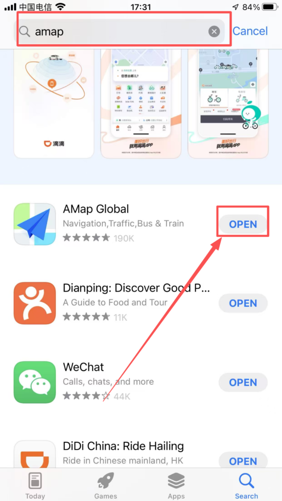
1.Search for ‘Amap’ in the app store, download and install it
2. Register an account
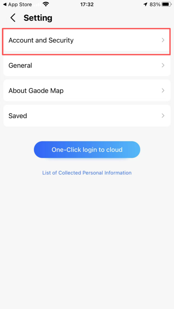
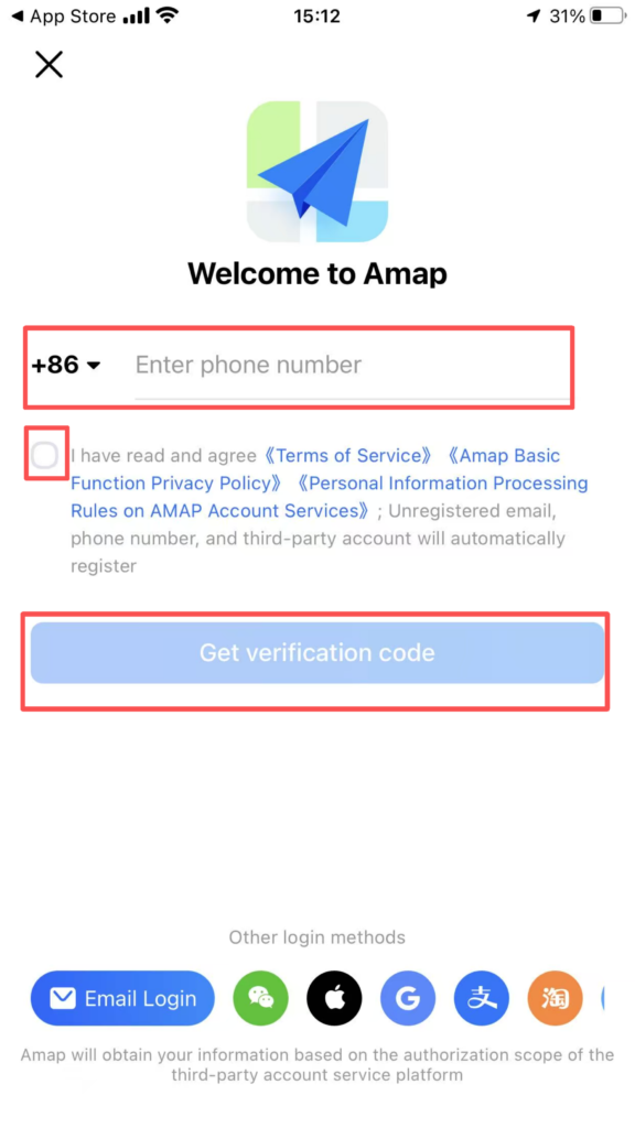
Register with phone number: Open the app, tap the settings icon in the top left corner, tap Account and Security, enter your Chinese phone number (86); tap Get Code, enter the SMS verification code.

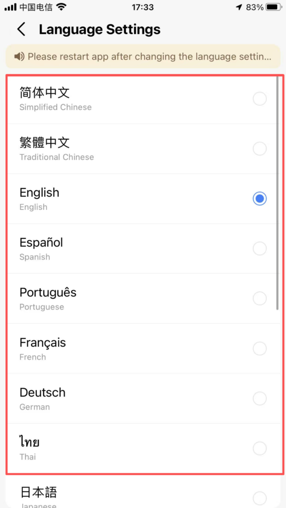
You can choose different languages:
Real-name authentication: Daily navigation does not require real-name authentication; only taxi/rides, payments, and developer functions require real-name authentication (using a passport/residence permit)
Detailed Explanation of Core Functions
1. Route Planning (Most Commonly Used)
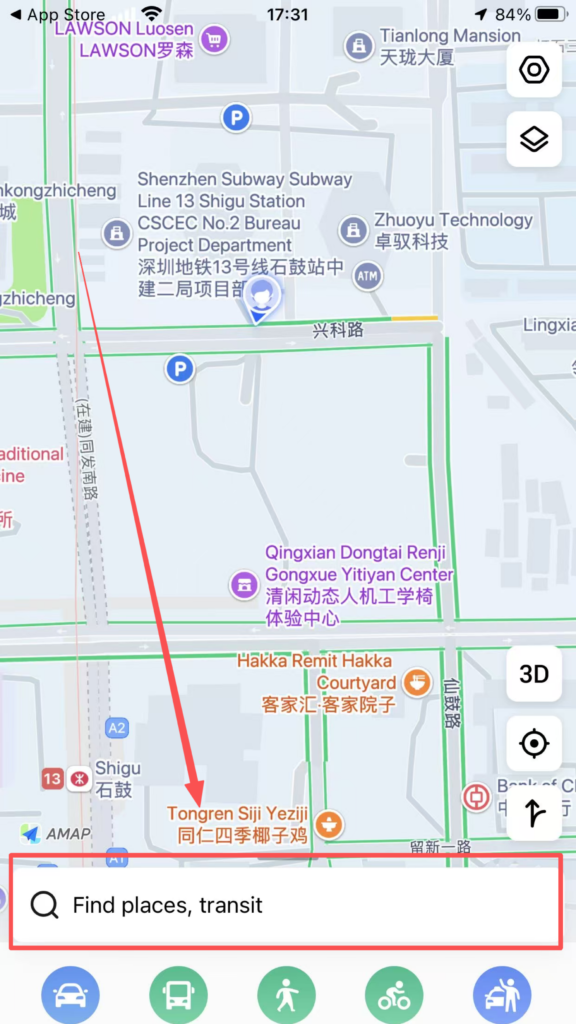
Entrance: Search Bar at the top of the homepage,Steps:
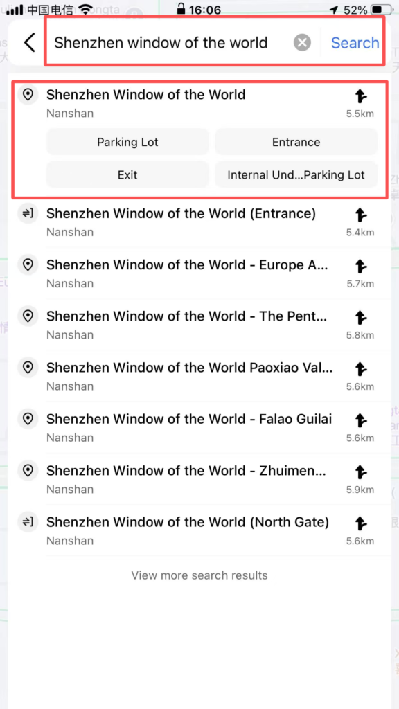
2. Enter From (starting point, default is current location), To (destination) Supports: English / Pinyin / Chinese (e.g., Window of the World, Shijiezhichan, 世界之窗)
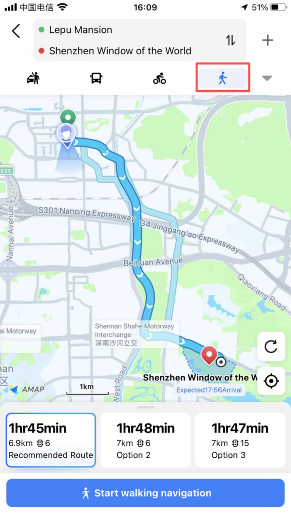
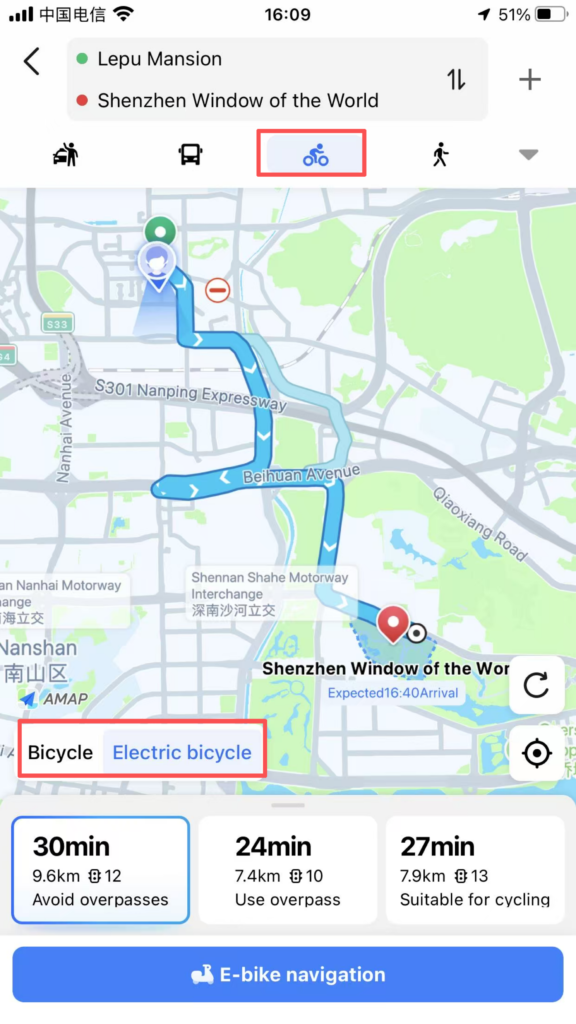
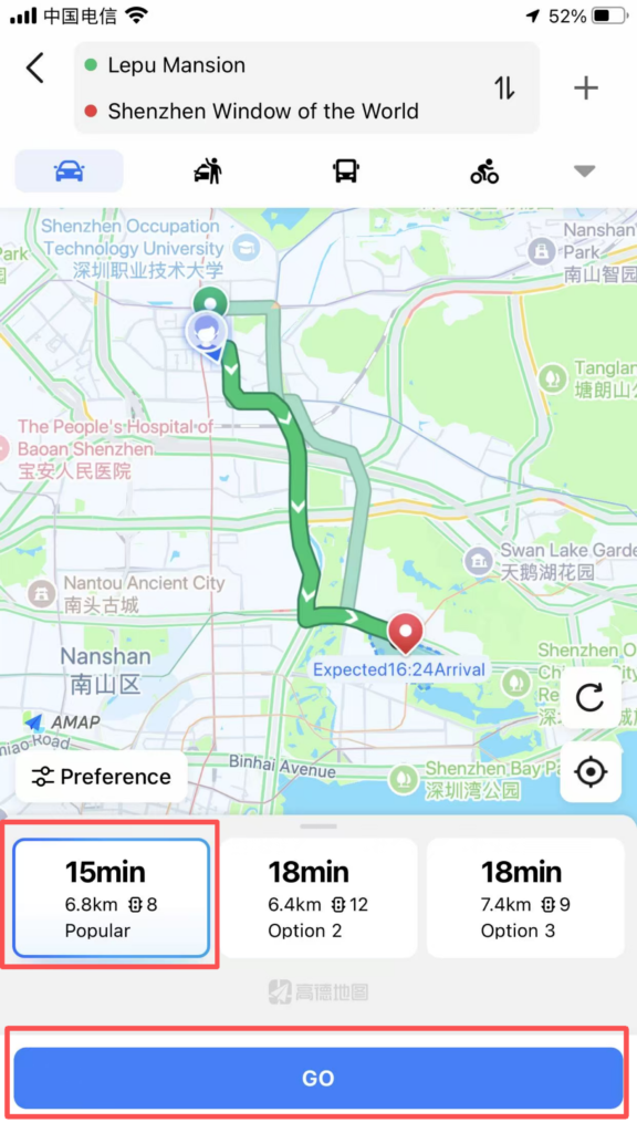
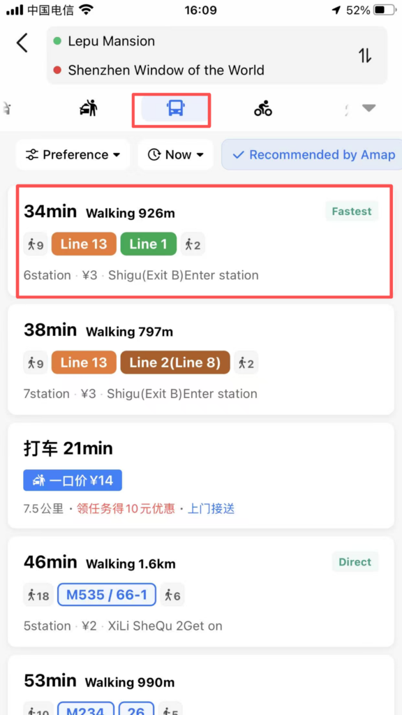
3. Choose the mode of travel:
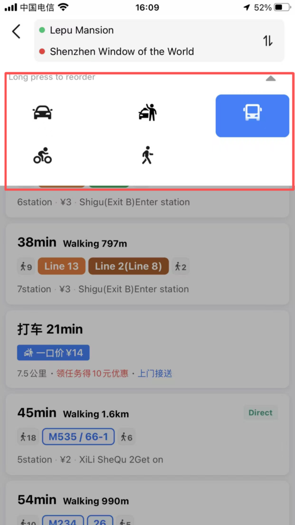
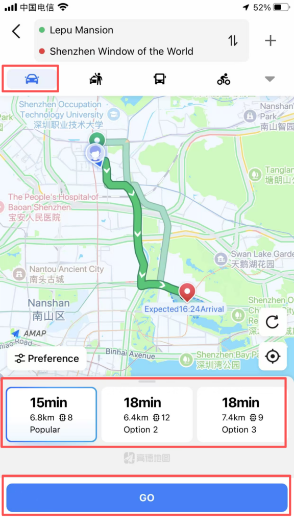
Drive: fastest route, avoid congestion, traffic lights / speed camera alerts
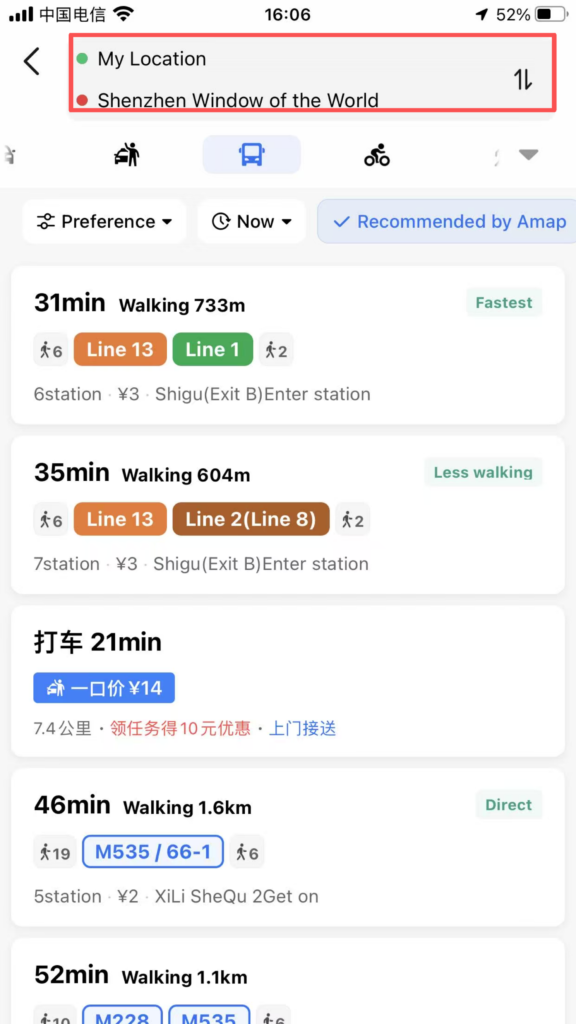
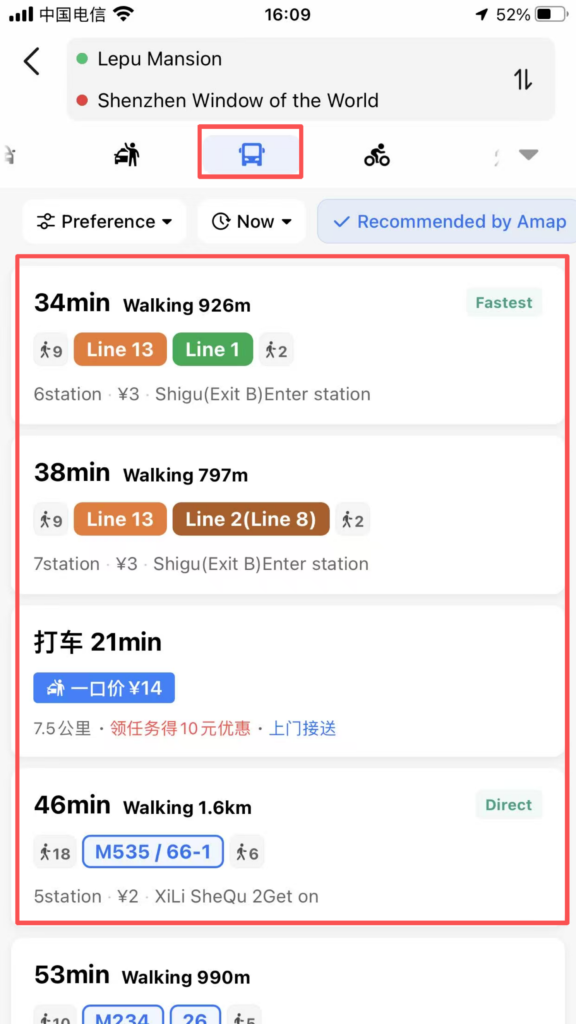
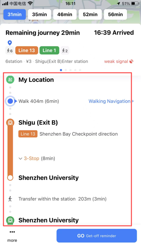
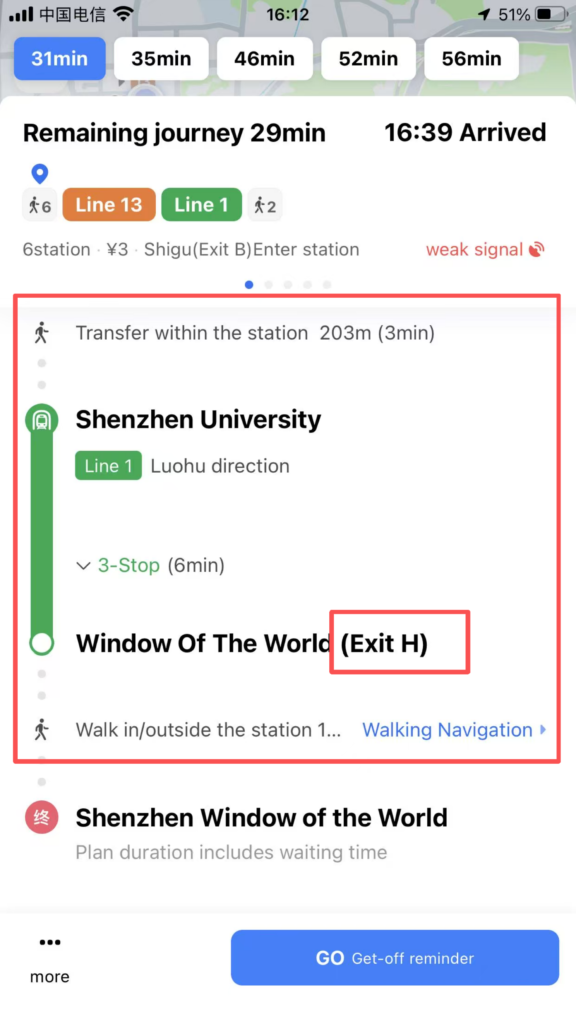
Transit (Public Transportation): Subway Bus Walking, including transfers, fares, duration, first and last departure times
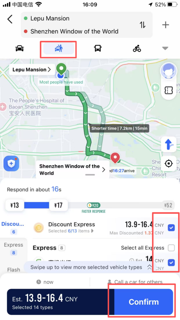
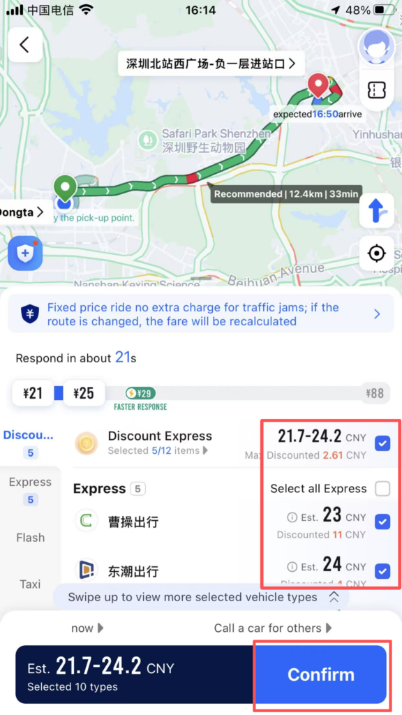
Taxi (Ride-hailing): Call a ride with one click, supports foreign cards (Alipay, Visa/Mastercard) for payment
Walk: AR real-scene navigation, shortest path, street-crossing reminders
Bike (Cycling): Dedicated route for bicycles / electric bikes
5. Click Start Navigation; Full English voice guidance and on-screen directions
6. Subway / Bus Navigation (Frequently used by foreigners)
Core Features:Display subway map in English, transfer stations, exit information (Exit A/B/C)Real-time bus arrival alerts, vehicle location tracking,Fare: Displayed in CNY (RMB), supports QR code / transit card payment
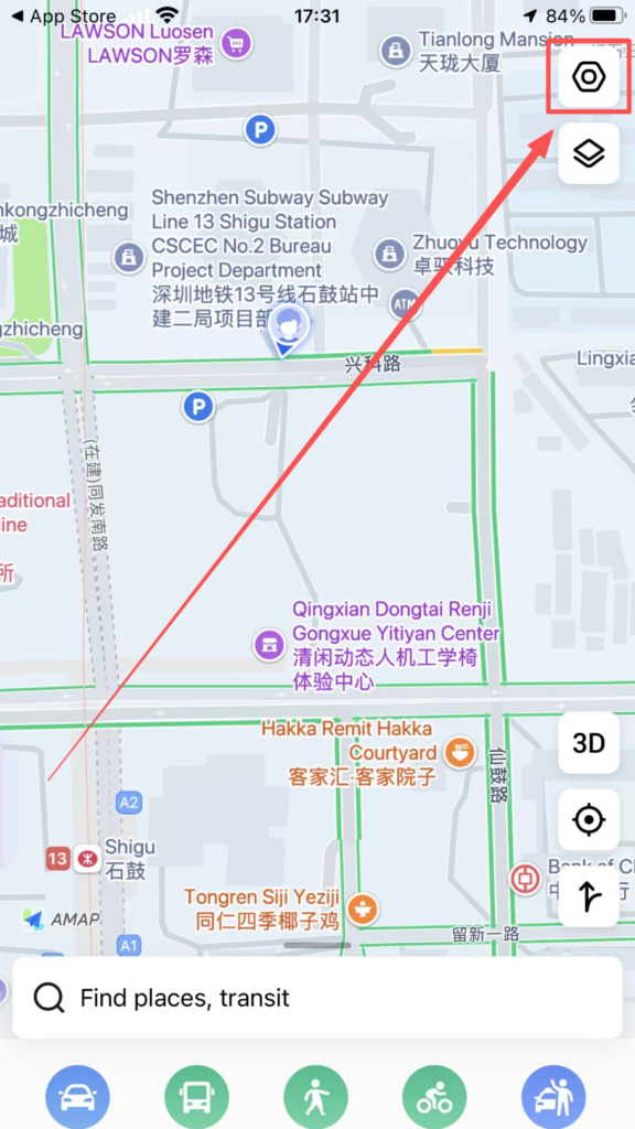
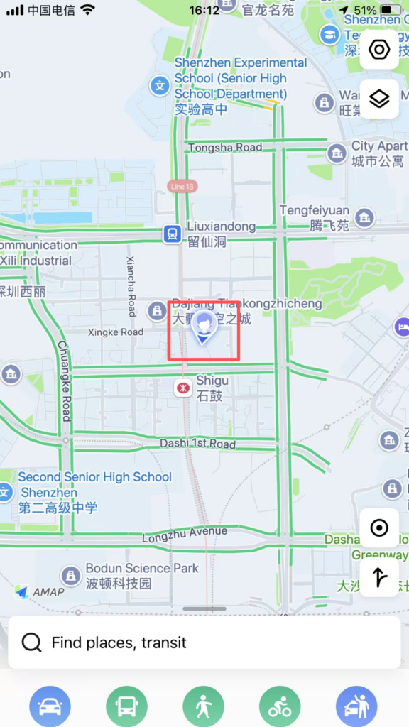
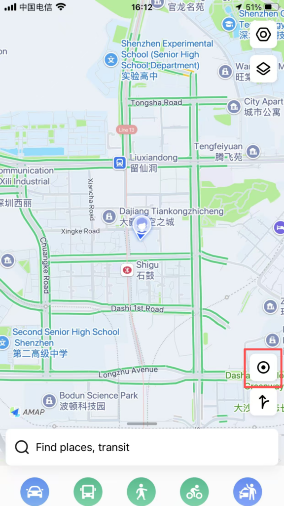
3. Map Browsing and Positioning
Home: Blue dot = your real-time location
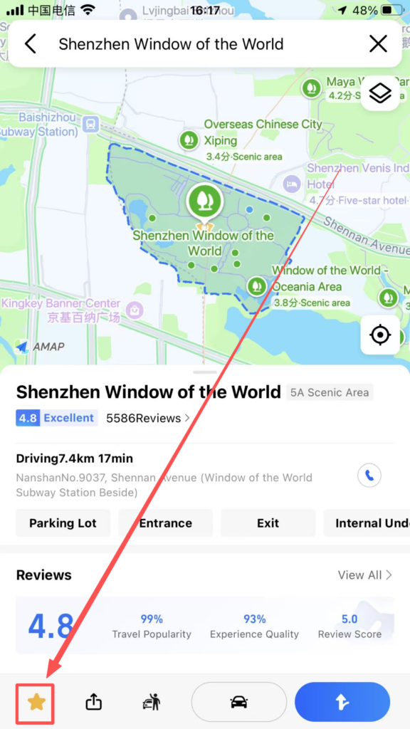
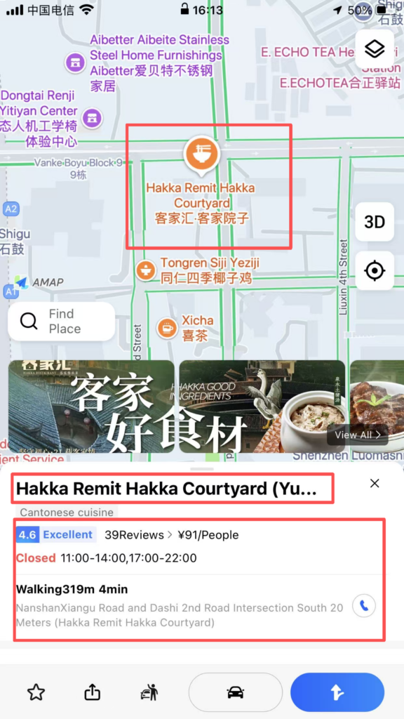
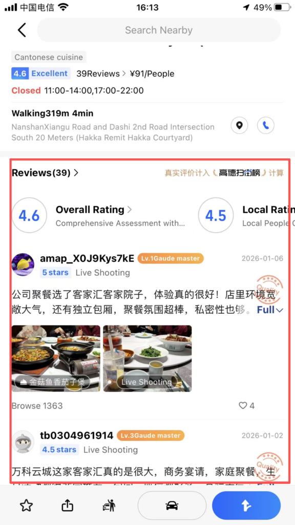
Operations:Pinch with two fingers to zoom / drag to view the map; tap the location icon to quickly return to your current location; tap a POI (place); view details (address, phone number, rating, business hours, reviews)
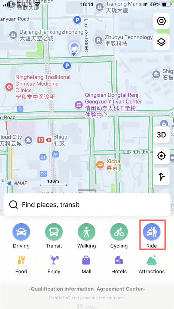
4. Taxi Feature
Entrance: Home Page Bottom RideOperation: Automatically locate the starting point, enter the destination; choose the car type (Express/Comfort Ride / Special Car);Confirm the ride; track the vehicle location, driver information, and estimated arrival time in real time.
5. Other Practical Features
Voice Navigation: English voice, enlarged intersection maps, lane-level guidance to avoid taking the wrong route
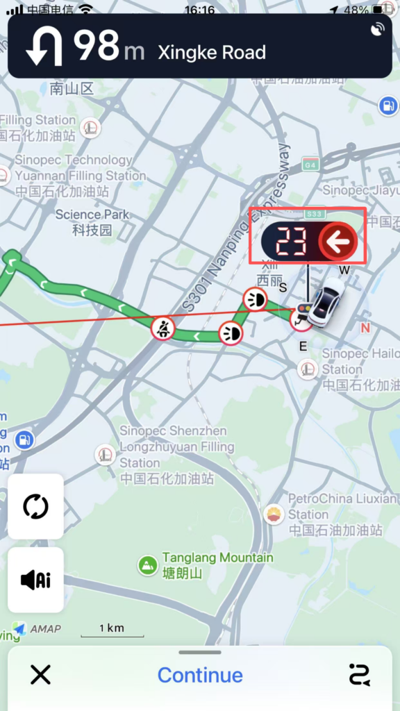
Real-time traffic: Red = Congested, Green = Smooth, Smartly avoid traffic jams
Favorites Management: Save frequently used locations/routes with one click, and call them directly next time